Ongoing Projects

We work with conservation teams to test practical sensing, robotics, and AI in real landscapes. Then we turn our insights into tools that improve with every deployment.

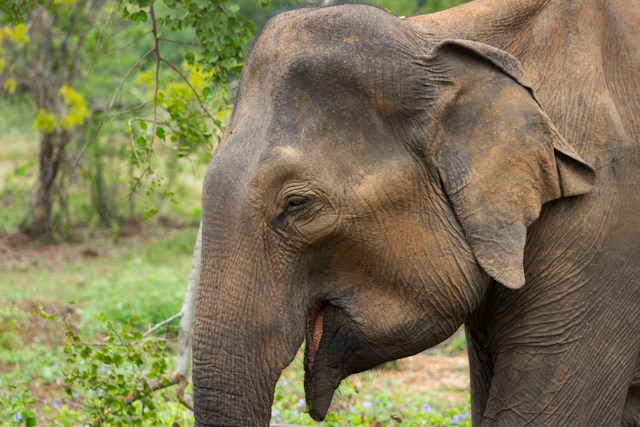
Elephant Conflict Monitoring

Thermal tracking and early warnings across elephant corridors.

Thermal aerial sensing

Drone mapping and early-warning coverage

Read More

Carnivore Habitat Monitoring

AI-powered camera-trap analysis for wolves and striped hyaenas.

Camera-trap AI

Automated monitoring for carnivores

Read More

Farmland Biodiversity

Multimodal sensing for wildlife in working agricultural landscapes.

Camera-trap AI

Automated monitoring for carnivores

Read More

Nighttime Elephant Tracking & Early Warning — with WNE India

Human–elephant conflict is a life-and-death problem across eastern India. From 2020 through 2024, elephant attacks killed 2,727 people in India; 910 of those deaths occurred in West Bengal and Jharkhand alone. WNE India has worked on human–elephant conflict since 2018 and now monitors multiple elephant corridors across West Bengal, Jharkhand and Odisha through field teams, village networks, and ecological studies. Together, we are working on a critical missing capability: knowing where a moving herd is at night, where it is heading, and whether a village lies in its path.

Habitat Robotics is developing a thermal-drone workflow with WNE for repeated day and night operations. WNE’s field teams and community network guide the search areas, while thermal and RGB imagery helps locate and follow herds, estimate their direction and proximity to villages, and plan reacquisition after battery changes. Daytime aerial mapping will add context around corridors, forest edges, crossings, and settlements.

WNE retains the judgement and community relationships that determine when an alert should be issued; our role is to give that team better and more timely information. Together, the teams are laying the foundation for automated thermal detection, predictive movement models, and coordinated drone operations that give conservation teams faster, more actionable information in the field.

Indian Grey Wolf & Striped Hyaena Conservation — with Durgapur WINGS

Some of eastern India’s most remarkable large carnivores are surviving alongside farms and villages. WINGS’ field research has identified at least 30 Indian grey wolves across four packs and 30 striped-hyaenas across six populations in industrial and mining landscapes. These animals are adapting to intensely human-shaped ecosystems, where livestock dependence, roads, and habitat fragmentation make understanding exactly how they use the landscape critical to their survival.

Habitat Robotics is leveraging WINGS’ camera trap data to better understand movement corridors and habitat usage patterns of these carnivores. We are integrating camera observations with geospatial data metrics, human activity and settlements to model temporal activity, detection intensity, and habitat use. For striped hyaenas, we are also exploring semi-automated identification from individual stripe patterns.

We combine WINGS’ field knowledge, camera trap data, and ecological context to reveal how wolves and hyaenas use the landscape and guide better corridor protection over time.

 Farmland Biodiversity Monitoring — Sahapur, West Bengal

More than 4.8 billion hectares—over one-third of the world’s land—are used for agriculture. Conservation therefore cannot end at the boundaries of forests and protected areas; biodiversity also has to persist in the landscapes where people grow food and live. Sahapur sits within West Bengal’s intensively cultivated lower-Gangetic landscape, where paddy fields and irrigation channels form a patchwork of potential habitat. We are studying how birds, amphibians and mammals use this agricultural matrix—and which small pieces of habitat allow wildlife to persist within it.

Sahapur is also Habitat Robotics’ living technology testbed. We are bringing together camera traps, acoustic monitoring, drone-based orthomosaic mapping and low-power environmental sensors to observe the same landscape from multiple perspectives. Through real-world testing, we are rapidly building and fine-tuning multimodal AI and automated species-recognition models against locally validated West Bengal wildlife data.

Sahapur is where we repeatedly test the full loop from sensor deployment → field data → AI interpretation → ecological analysis → better deployment. Every iteration strengthens a reusable monitoring stack that can move from this small agricultural landscape into larger conservation deployments—while producing an expert-validated picture of the wildlife living alongside people in Sahapur today.

Let's build better conservation tools together

Tell us what your team is working on. We’d love to explore how practical AI, robotics, and sensing could support your work in the field.